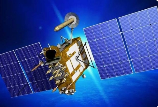
Russia has a commercial satellite that has the ability to transmit communication, reconnaissance, navigation and weather broadcasts. The satellite is called the Glonass satellite. The formation of Glonass began when there was the creation of the first radio navigation satellite made by the Russian state, the satellite was called a cyclone. This satellite is capable of providing information accurately about the whereabouts of a person, even a ship.
In 1967 the first cyclone was launched as a navigation guide in warfare. Russia wanted to develop its big project with the Glonass satellite guidance with the support of developing technology. By fulfilling all its requirements since 1970, the first Glonass navigation system was designed for the first time in 1957 by VSShebashevich, as stated quoted in glonass–iac-ru.
This idea was born during the investigation of several possible applications of radio-astronomy technology for flight navigation. Further investigations were carried out in a number of Soviet institutions to improve the accuracy of navigation definitions, global support, daily application, and independence from weather conditions.
In 1982 the first satellite was launched, and the system was fully operational in 1993. Russia then committed to upgrading the system after a period of decreased performance to the required minimum of 18 active satellites. The space segment of this satellite consists of 24 satellites, in three orbital planes, with eight satellites per plane.
The constellation geometry repeats every eight days. The orbital period of each satellite is approximately 8/17 sidereal 1 day so that after eight sidereal days this satellite has completed exactly 17 orbital revolutions. Each orbital plane contains eight equally spaced satellites.
The satellites of glonass one of them will be in the same place in the sky at the same sidereal time every day. The satellites were placed in a nominally circular orbit with a target tilt of 64.8 degrees and an orbital radius of 19,140 km, about 1,060 km less than the GPS satellites.
The control segment consists of a system control center and a network of command tracking stations throughout Russia. In addition, command tracking can now be used worldwide, including in Indonesia.
Glonass has advantages as a navigation tool: Just like with other navigation devices, Russian navigation also has the advantages offered including the following:
- Devices that vary Glonass currently has many variations including that it can also be used on clocks, cellphones and other digital devices.
- Orbital position that is closer to the earth Orbital position that is closer to the earth makes the level of accuracy better, especially if it is not tracked using GPS navigation.
- A more affordable price For personal use, perhaps most users of this satellite have the impression that it is affordable, when compared to the level of accuracy offered.
- Low power consumption level If you use this satellite, the power consumption level will be much lighter, this can be proven when this satellite is successfully implemented in watches. ***